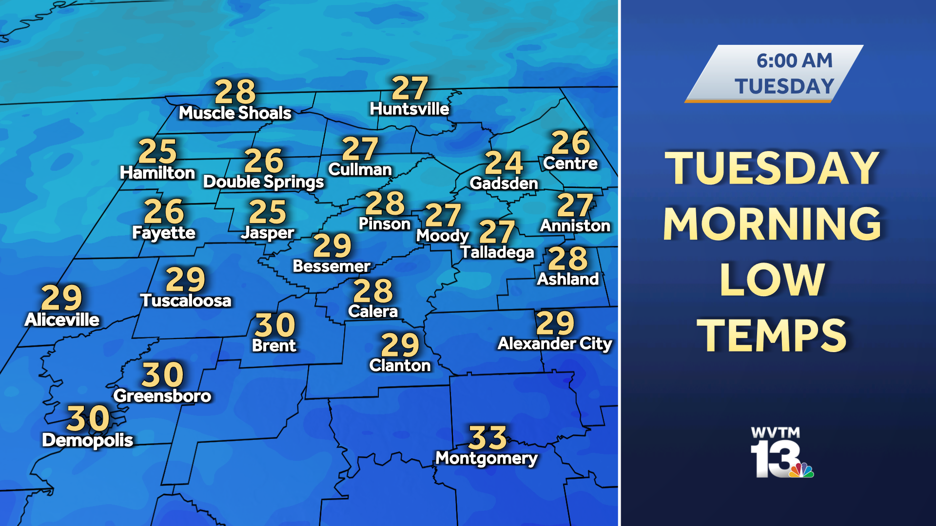

Some of the coldest air of the season so far settles in for Tuesday and Wednesday, and then some of the wettest weather in months develops into the weekend. Check the video forecast for the latest. Arctic air blowing over Alabama through early Tuesday morning means a freeze is likely.
Temperatures tumble to the middle and upper 20s by sunrise under a mostly clear sky, and some of the usual cold spots could be near or below 25 degrees for more than 4 to 6 hours before sunlight starts to burn off that chill. Tuesday sets up like Monday: a mostly sunny sky, a light north-northeast wind around 10 miles per hour, and a chilly afternoon. Expect a high temperature only in the low-50s at best by 3 p.
m. Another long-duration freeze comes Tuesday night into Wednesday morning with some of the coldest readings of the season thus far. Low temperatures plunge to the lower and middle 20s for more than 4 to 6 hours again, and a few spots in the usual cold pockets could briefly hit the upper 10s by sunrise Wednesday.
Wednesday is the pivot point between the cold, dry start to the week and what looks like the best shot at a widespread soaking rain for Central Alabama in months. The air warms a bit Wednesday (middle to upper 50s), and it gets milder still on Thursday (in the 60s) with thickening clouds. Those clouds signal the arrival of a series of dynamic storm systems that could pour several inches of rain across the state from late Thursday evening through next Monday.
The heaviest rain looks to be south of Birmingham, but there is a good chance that most of us from the Gulf Coast to the Tennessee border get at least one to two inches of rain in that period. Some South Alabama communities could get more than 3 or 4 inches by Monday. That, of course, means we must contend with some wet weather over the upcoming weekend including travel to and from the SEC Championship Game in Atlanta, many outdoor Christmas season activities like live nativities, markets, and light displays.
Expect high temperatures on Saturday and Sunday near 60 degrees with occasional periods of rain. All is not lost for the weekend, though. There will be some breaks in the rain Saturday afternoon and early evening when rain is not pouring down.
Christmas is less than four weeks away, and the weather at the start of December looks mild and rainy. December does not usually end how it starts, though. It is a very volatile weather month for the South.
It is far too soon to get a clear picture of the weather on Christmas Eve and Christmas Day in Alabama, but we can start looking at the general patterns that far in the future. As of now, we do not see any “wild” patterns in late December that would cause extreme weather for Alabama. That does not mean it cannot happen, though.
It is a long way out! “Normal” for us around Christmas means highs in the lower 50s, low temperatures around 32 degrees, and at least some chance of rainfall. Approximately one-quarter of Christmases have at least 0. 01 inches of rain (or snow), but only about 5 percent of them more than one inch of rain.
STAY WEATHER AWARE For the latest weather coverage for your area, click here . And stay updated with alerts in the WVTM 13 app. You can download it here .
For the latest Birmingham weather information and central Alabama’s certified most accurate forecast, watch WVTM 13 News . Don’t forget to follow us on Facebook , Twitter and Instagram . .
From: wvtm13
URL: https://www.wvtm13.com/article/alabama-weather-forecast-december-christmas-rain/45954803